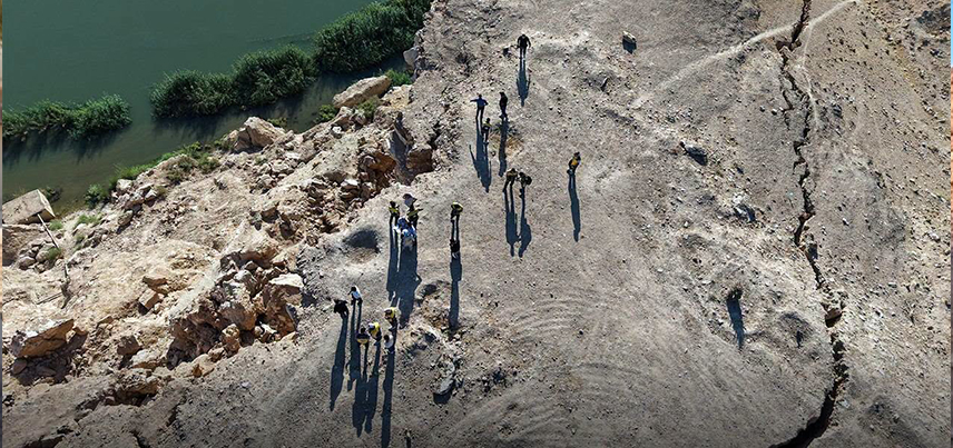
Joint Technical Committee Issues Report on Landslides in Al-Baghouz, Deir ez-Zor
The joint committee tasked with investigating landslides in the Al-Baghouz area of Deir ez-Zor Governorate has issued its final technical report. This follows field inspections and specialized studies conducted with experts from the General Establishment for Geology and Mineral Resources (Ministry of Energy) and the National Center for Seismology (Ministry of Emergency and Disaster Management).
The report indicates that the cracks, depressions, and landslides observed in the area are primarily linked to hydrological and geomorphological factors. These include the impact of flowing water and changes in saturation levels and water pressure within surface deposits and clay formations, leading to soil instability and landslides toward the watercourse.
The report clarifies that seismic activity recorded in the area—with a magnitude not exceeding 3.8—does not account for the scale of the observed surface deformations. It also rules out a direct link to the Şanlıurfa earthquake, given the significant distance between the two locations. Furthermore, field inspections revealed no direct surface indicators of recent tectonic activity or active faults responsible for the cracking.
The committee recommended removing rock and gypsum masses at risk of collapse, conducting detailed geological and geophysical studies, and carrying out a precise topographic survey of the area. It also called for completing the necessary studies to determine appropriate remediation measures and mitigate potential risks, thereby ensuring the safety of the local population.
- Email: info@moenergy.gov.sy
The Joint Technical Committee issues its report on landslides in the town of Al-Baghouz, in the eastern countryside of Deir ez-Zor.